The River Thames Scheme: How Ecological Surveys are Informing Design, Site Investigation and Habitat Enhancement – by Lucy Robertson and Joe Whittick
Ecologists Lucy Robertson and Joe Whittick discuss the scheme’s ongoing habitat and wildlife survey work and its vital role in ensuring long-term success
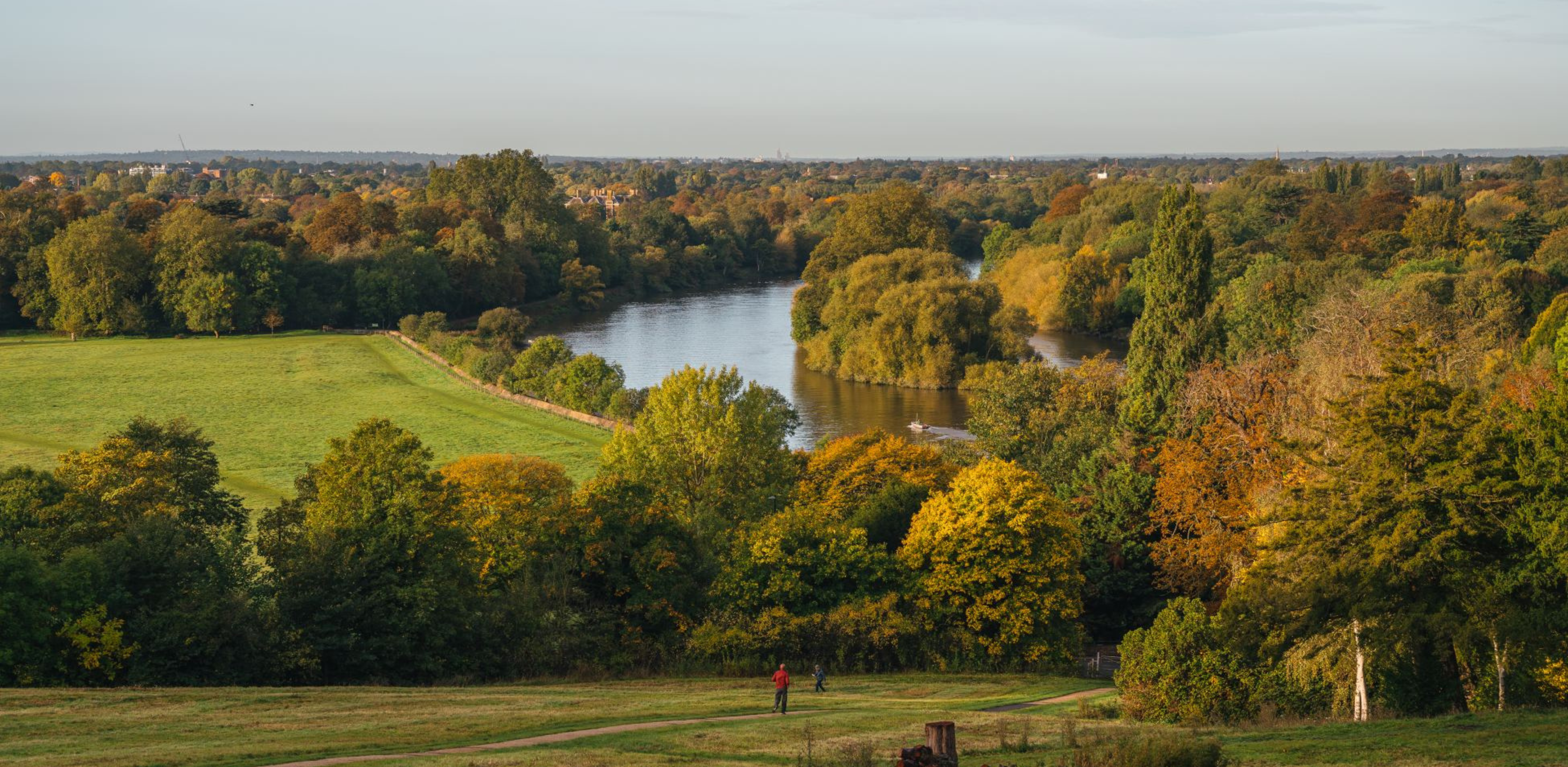
Focused on an area between Egham in Surrey and Teddington in Greater London, the River Thames Scheme (RTS) is a major infrastructure project being delivered by the Environment Agency and Surrey County Council that will reduce the flood risk for more than 11,000 homes and 1,600 businesses as well as for key elements of infrastructure. In addition, it will create green open spaces for recreation, increase biodiversity, add sustainable travel routes and provide a response to the dual challenges of climate change and nature recovery.
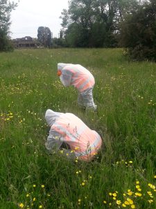
Binnies Ecologists combing a meadow in a transect system within the survey area for Downy-Fruited Sedge Carex filiformis
The RTS is currently engaged in a wide-ranging survey programme to widen its understanding of the existing ecology and biodiversity within the scheme area so it can be protected and, where possible, enhanced. The extensive survey work completed to date will help to guide design work and inform ongoing survey requirements to ensure that an up-to-date ecological baseline is available throughout the project development and execution.
Habitats Regulations Assessment
The RTS area is close to the South West London Waterbodies Special Protection Area (SPA) and Ramsar site. These sites are primarily designated for their over-wintering populations of gadwall (Anas strepera) and shoveler (Anas clypeata).
The project’s consultant ecologists, WSP Binnies, carried out winter bird surveys of the scheme area in 2021/2022. These found that several lakes through which the proposed flood channel will pass support the two qualifying species of the SPA and Ramsar site, and that a Habitats Regulations Assessment (HRA) would therefore be required for works that affected these. While the HRA for the main scheme is yet to be produced, the requirement for ground investigation (GI) at the lakes within the scheme area necessitated a separate HRA to ensure any impacts on qualifying species could be avoided.
The GI works included the use of a pontoon to take samples from the lake beds. These works presented a significant risk of disturbing qualifying bird species if undertaken at a sensitive time of year. To manage this risk ecologists monitored the lakes in advance of scheduled GI works. This process included dawn bird surveys by the ecological clerk of works (EcCoW) to record the numbers of qualifying bird species present when GI works were planned to be undertaken.
Where numbers of gadwall and/or shoveler were found to be above a threshold agreed with Natural England, works were either delayed or completed under strict supervision of the EcCoW to ensure there was no disturbance. The results from the GI monitoring surveys will now be used to inform the HRA for the main RTS project.
EcCoW support has also been provided for the GI works in relation to checks for nesting birds, badger and reptiles in advance of any required habitat removal. A variety of invasive non-native species (INNS) are also present within the RTS scheme area, including zebra mussel. The GI works required the movement of the sampling pontoon and associated drilling equipment between waterbodies, and the EcCoW was responsible for monitoring this to prevent the spread of INNS, primarily by ensuring that effective clean/check/dry procedures were implemented.
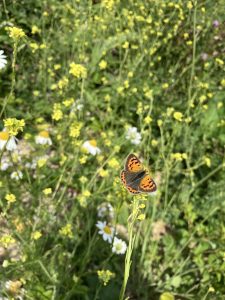
Small Copper Lycaena phlaeas observed on site
Ecological surveys
A range of ecological surveys have been completed as part of the RTS. The results of these will be incorporated into the Environmental Impact Assessment (EIA) and will be use
d to assess the impacts of the scheme and to influence the design and determine mitigation and compensation requirements. The surveys incorporated the location of the proposed flood alleviation channel, as well as areas of land proposed for habitat creation or enhancement as part of the project.
Detailed proposals for the habitat creation areas are currently under development. Our ecological survey work will be used to ensure that the mitigation hierarchy is adhered to, with existing high-value features retained and enhanced wherever possible. It will also guarantee that new habitat creation is appropriate to the area and that biodiversity outcomes can be combined successfully with other aspirations of the project in relation to providing additional green space for recreation and active travel routes.
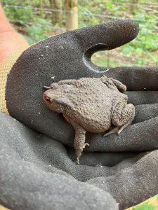
Adult toad observed on site
Habitat surveys
We have completed a full UKHab survey of the scheme area, including habitat condition assessments. This survey has been used to target additional surveys and will also help us calculate a biodiversity unit baseline as part of the delivery of biodiversity net gain (BNG) for the project.
The UKHab survey identified a number of high-value habitats which are currently undergoing full National Vegetation Classification (NVC) surveys. Overall, the habitat surveys completed to date have identified multiple sites that could be significantly improved through targeted management.
For example, significant numbers of orchids (pyramidal and bee) were recorded at one survey location; a discovery that will influence the long-term management proposals for that area. At a second site, downy-fruited sedge (Carex filiformis) was identified. This species is nationally rare in the UK and mostly restricted to Berkshire, Gloucestershire and Oxfordshire. The results of the NVC survey were used to develop avoidance measures to ensure that GI works in the associated grassland did not impact this species through a methodical combing technique to identify the plant and use of markers to avoid disturbance under EcCoW supervision.
Hedgerow surveys
We have completed around 50 hedgerow surveys this year and have identified a number of species-rich hedgerows within the scheme area. These high-value habitat features will be retained wherever possible, with hedgerows which were found to be in poor condition targeted for improved management.
Hedgerow assessments are also a good example of where habitat survey data has been used to determine future survey requirements. In this case, the presence of blackthorn identified during hedgerow surveys has been used to inform where brown hairstreak butterfly may be present and further investigation is required.
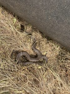
Female grass snake at one of the potential HRA sites
Protected species surveys
In addition to habitat surveys, a variety of protected species surveys have been completed this year. These include great crested newt Habitat Suitability Index (HSI) and eDNA surveys of 39 ponds, reptile surveys of 17 sites totalling over 430 hectares and utilising over 600 artificial reptile refugia, badger camera trapping at potential sett locations combined with additional badger walkovers and drone surveys, otter camera trapping, bat surveys of multiple buildings and trees, and invertebrate surveys of grassland and woodland sites.
Great crested newt eDNA surveys all returned negative results consistent with surveys in previous years. However, a variety of common amphibians (including smooth newt and common toad) were identified within the scheme area and appropriate avoidance measures will be developed to ensure that impacts on these species are minimised.
Reptile surveys identified good populations of grass snake at some locations and one site which supports significant numbers of slow worm. A single common lizard was also recorded in an area where there have previously been no confirmed populations. The 2023 surveys did not identify any evidence of badger or otter activity, but these findings will be combined with positive results from previous years to inform a programme of ongoing surveys and monitoring to help us understand the distribution of both these species within the scheme area and to assess potential impacts and opportunities.
Invasive non-native species (INNS)
INNS are a significant issue where the RTS is located. The first task for the team has been to understand in more detail the current distribution, through terrestrial and aquatic INNS surveys completed in 2022.
The terrestrial survey identified eight terrestrial INNS listed under Schedule 9 of the Wildlife and Countryside Act 1981 (as amended) or Schedule 2 of the Invasive Alien Species (Enforcement and Permitting) Order 2019, with an additional 11 species listed as concern as part of the London Invasive Species Initiative (LISI). A total of 36 aquatic INNS were also identified, 19 of which were plants and 17 macroinvertebrates.
Precautionary working methods in respect of INNS have been applied to the GI works completed in 2023 under the supervision of the onsite EcCoW. The project will also use the survey information to develop an INNS management strategy for when the project is operational.
By Lucy Robertson, Graduate Ecologist, and Joe Whittick, Principal Ecologist (MCIEEM), at WSP Binnies, working on behalf of the RTS.
Blog posts on the CIEEM website are the views and opinions of the author(s) credited. They do not necessarily represent the views or position of CIEEM. The CIEEM blog is intended to be a space in which we publish thought-provoking and discussion-stimulating articles. If you’d like to write a blog sharing your own experiences or views, we’d love to hear from you at SophieLowe@cieem.net.