The River Thames Scheme: a Landscape-based Approach to Creating a Healthier, More Sustainable and More Resilient Community – by Jeanne Capey
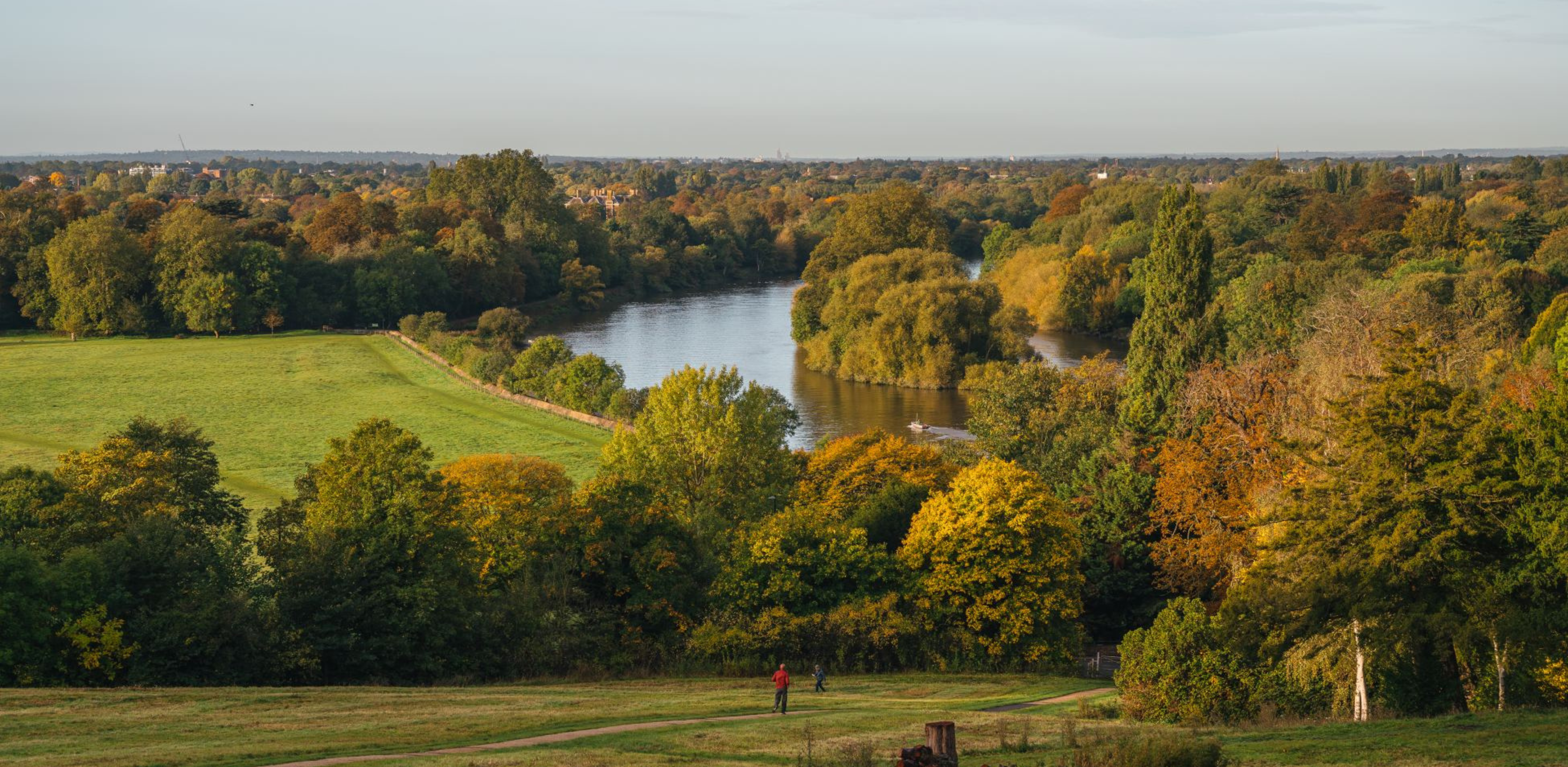
Between Egham and Teddington, the River Thames runs through the largest area of populated but undefended flood plain in England. In addition to its towns and villages, the landscape here has been shaped by major infrastructure and industry. This has created a region where many built-up areas are vulnerable to flooding and open space often isn’t used to its full potential.
The River Thames Scheme (RTS) will reduce that flood risk for more than 11,000 homes and businesses as well as for key elements of infrastructure such as roads, railways, electricity and drinking water networks. At the same time, it will deliver green open spaces for recreation, increase biodiversity, add sustainable travel routes and provide a response to the dual challenges of climate change and nature recovery.
A partnership between the Environment Agency and Surrey County Council, the RTS will create a five-mile (8km) river channel built in two sections through the boroughs of Runnymede and Spelthorne in Surrey. There will also be capacity increases around the Desborough Cut (a man-made channel created in the River Thames near Shepperton in the 1930s) and the weirs at Sunbury, Molesey and Teddington.
The Runnymede section of the channel will be three miles (4.8km) long. Starting at Egham Hythe and ending at Chertsey, it will flow through five lakes, intersect four existing watercourses and flow beneath five roads, including the M3 motorway.
The Spelthorne section will be two miles (3.2km) in length. It will start at Laleham and end at Weybridge. This section will flow through three lakes and cross several roads.
In flood conditions the channel will provide extra river capacity. As water levels in the River Thames rise, the channel will gradually carry the additional flow so the water in the river stays within its banks. This continues until the channel is “full” and no more flow can be diverted into it. At this point, the river will start to flood. However, because the channel and additional weir gates provide extra capacity, the risk of flooding will be greatly reduced.
In normal circumstances, when there is no flooding, the new river channel will still contain water and will look much like a long-established river – providing both a habitat for wildlife and a place of recreation.
In addition to the water management aspects of the RTS, we will be working closely with communities and local wildlife groups to deliver the environmental benefits of the scheme. The RTS will achieve biodiversity net gain by creating a new network of high-quality habitat, in addition to improving people’s connections with wildlife, increasing access to green open spaces and delivering a more sustainable travel network.
We recently ran a successful consultation with communities and stakeholders to share our plans for the RTS and we expect to hold another consultation later this year.
One of the most important elements of our design work involves understanding how the scheme will affect the environment. Our Environmental Impact Assessment (EIA) will look at the current situation along the RTS route and assess what impact construction and operation are likely to have.
As part of our work to manage environmental impact we have been carrying out hundreds of ecological and environmental surveys. These have focused on a range of species including bats (and their roosts), water voles, breeding birds, otters and great crested newts. We have also been undertaking archaeological surveys, waste sampling and gas monitoring.
One initial highlight has been the discovery of a nationally rare mayfly (Caenis beskidensis). This had not been recorded in the UK for 49 years and had never been seen in the River Thames.
The invertebrate, historically found in small and medium-sized streams, was last spotted in Herefordshire in 1973. It was discovered, in nymph stage, during our routine survey work. The find represents a major expansion in both the distribution and habitat type the species has generally inhabited.
This exciting discovery demonstrates the importance of our surveys. By establishing the value of existing habitats in and around the Thames the scheme will be able to implement plans to protect them during the work and help them thrive in the future.
Mayflies form an important part of the river eco-system and are a major food source for fish and, once transformed into their adult form, insectivorous birds. Caenis beskidensis, for example, has been recorded previously in upper areas of lowland rivers where they live in slow-flowing shallow water. The RTS will create more of this kind of habitat and we are hopeful new colonies of this rare species will thrive.
Our aim now is to widen our understanding of the existing environment so we can continue to protect and, where possible, enhance it through the RTS. Finding rare and unexpected species is always exciting and we will continue to monitor the environment in our survey work throughout construction and the operation of the scheme.
To find out more about the River Thames Scheme or to get in touch visit our website at riverthamesscheme.org.uk
 Jeanne Capey is Project Director of the River Thames Scheme.
Blog posts on the CIEEM website are the views and opinions of the author(s) credited. They do not necessarily represent the views or position of CIEEM. The CIEEM blog is intended to be a space in which we publish thought-provoking and discussion-stimulating articles. If you’d like to write a blog sharing your own experiences or views, we’d love to hear from you at SophieLowe@cieem.net.