Going digital: The importance of GIS skills building when outsourcing is the norm
Written in anticipation of CIEEM’s 2026 Scotland Conference, Fieldwork Futures: Innovations in Ecological Practice, where Claire Birnie will be hosting a workshop on behalf of Maptastic.
Claire Birnie, founder of Maptastic shares insights on how Ecologists can, and should, think about their digital data, their technology stack and where they’ll be investing their time and money.
The conversation about going digital in the ecology sector isn’t new. But it’s an area where the speed of change makes it difficult for those who haven’t embraced it or don’t know where to begin, whether that’s building GIS skills in-house or handing them over.
Do you:
- Outsource it to an app or SaaS model?
- Test out and learn new software or techniques?
- Stay with what you know?
Each of these has pros and cons, whether you’re a freelancer, small business owner, or a large team, making the choice isn’t easy.
And there’s a cost to any change.
What’s changing? (Yep, I’m starting with the bad news.)
You know about the shifting baseline for environmental degradation. It’s the same for the way we’re expected to work and the technology stacks we’re supposed to be using. What’s now expected from the ecology sector in terms of data collection, mapping and standards has changed from the plain old pen and paper – although that’s still about.
There’s a lag in everyone being digital-first, but the introduction of BNG has made the precision and accuracy of field data collection far more important. Those who’ve adopted going digital will have seen the benefits of faster and more streamlined workflows. But they’ll also have felt the cost of getting there.
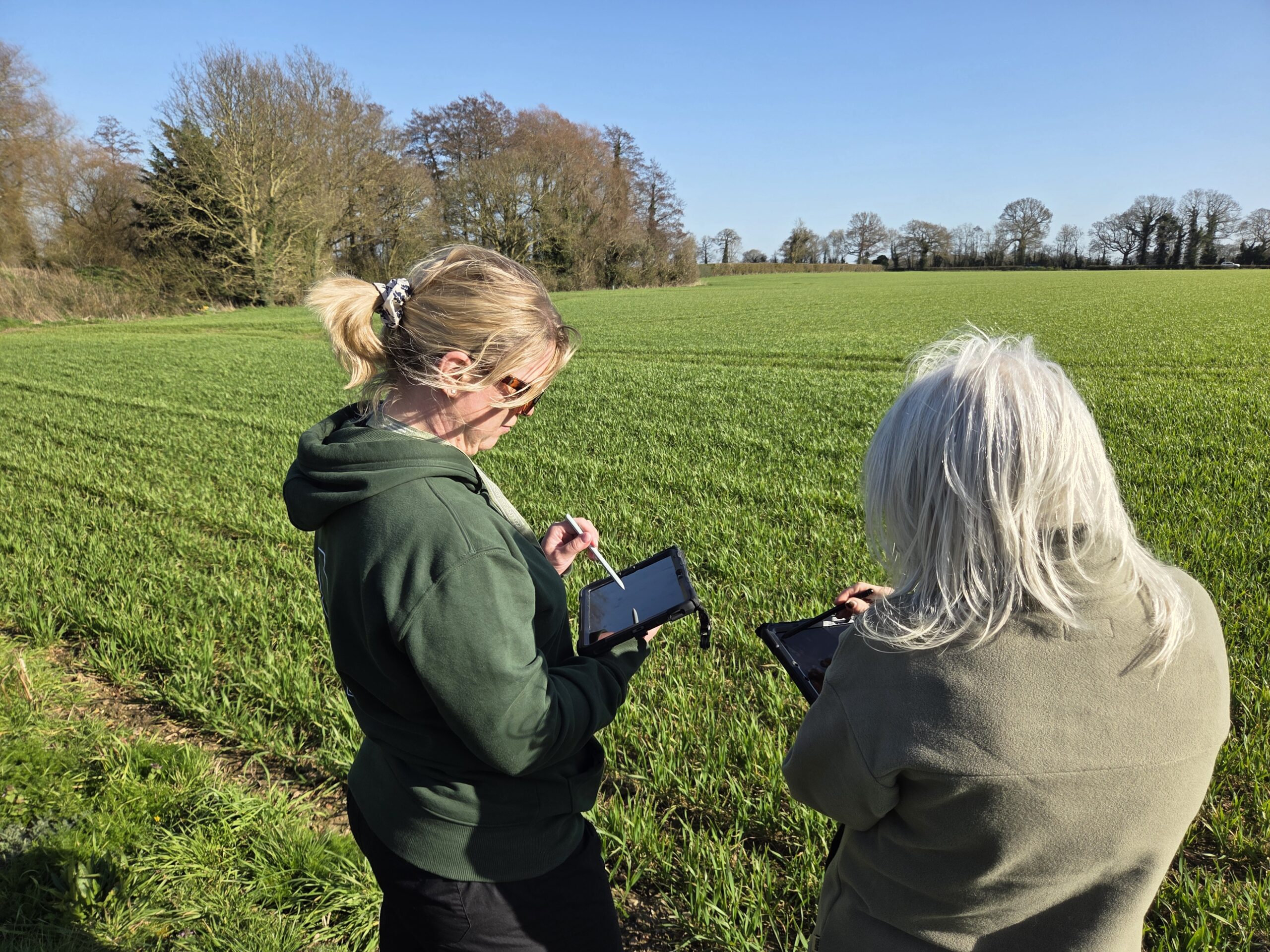
Figure 1 – Embedding digital data collection in the field
What are the costs?
The most obvious one is the £££ outlay; that’s usually the priority consideration. This can be a one-off or a monthly fee and there’s hidden costs too, like implementation, training and learning a new workflow. In outsourcing the level of control on features, updates and ability to amend is normally limited.
If you’re building internally, the monetary cost is lower as there’s no invoice to pay, but there’s a steeper learning curve for development and testing. However, in learning and developing this way you’ll have something that fits your needs, you can edit and fix it as well as levelling up your skills (and GIS is an excellent transferable skill).
Where should you focus?
That depends on your work, your business model, your capacity for change and the cost of that change. I believe in doing what’s best for you and your business. And sometimes the best solution isn’t the perfect one. It’s the one that is actually used.
This could mean outsourced, bringing in a consultant or self-built:
- Research, development and implementation costs, but you’re investing in yourself and your business.
- The use of digital data in ecology covers a lot of different methods. Learning and embedding those skills — rather than always turning to SaaS models — means you can work your way out of an issue and resolve it in your own time.
- Using the technology that’s going to get used is better than having the most advanced tech stack sat there gathering dust.
- QGIS Model Builder is a skill that’s worth investing in and makes light work of tasks you complete regularly, following the same steps to save you time and resources. Pretty cool, eh?
The apps, subscriptions and SaaS models aren’t inevitable
You’ll have seen the apps and SaaS models over the last few years and they’re both convenient and remove a lot of the barriers to going digital, but handing over your workflow isn’t something you need to do. Whether you’re a freelancer or a small consultancy, keeping your workflow in-house means it’s built for your needs and gives you full control.
Climbing on my soap-box for a second, I believe that if you can maintain the ownership on how you work and your processes then do. Even if that’s a workflow that’s designed for you, rather than you doing it, means it’s tailored to what you need – not someone else’s idea of it.
I’m gonna show you what QGIS Model Builder can do
In the workshop, Fieldwork futures: Innovations in Ecological Practice, I’m delivering at the 2026 CIEEM Scottish conference. I’m hoping to convince you to invest in yourself and be curious about doing things yourself.
That’s why I’m introducing Model Builder in QGIS and getting you to use it to complete a task you’ll likely repeat for every habitat survey report you write: finding the distance and direction of statutory sites from your survey site.
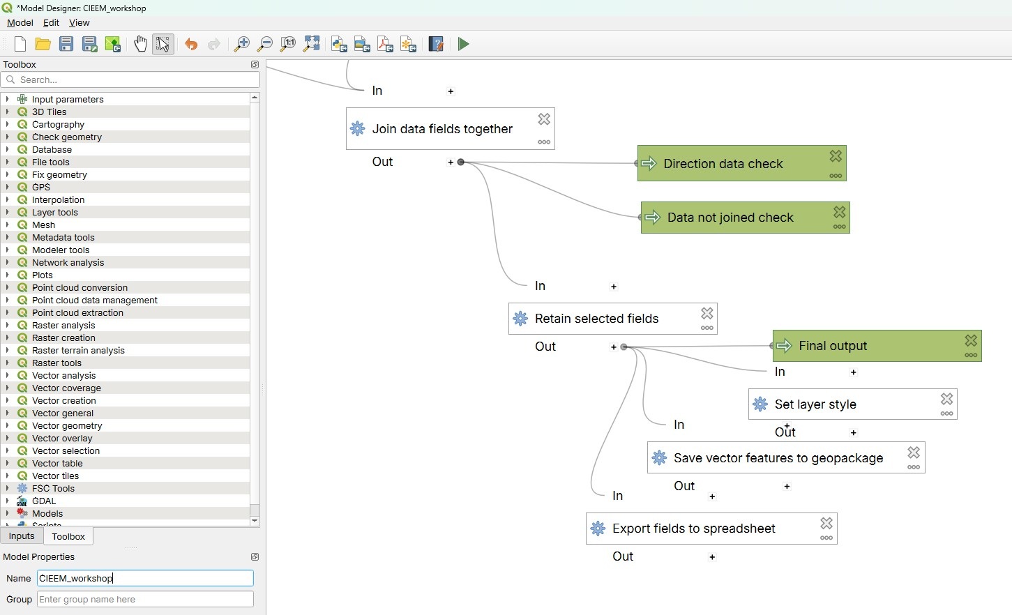
Figure 2 – Screenshot of building in qgis model builder
Okay, I know you can look this up easily enough, but I’m hoping to show you how to build geospatial models for yourself, so you can take ideas for your own workflows and build them out. There’s a real need in the sector for people creating new ways of doing things, particularly in small businesses.
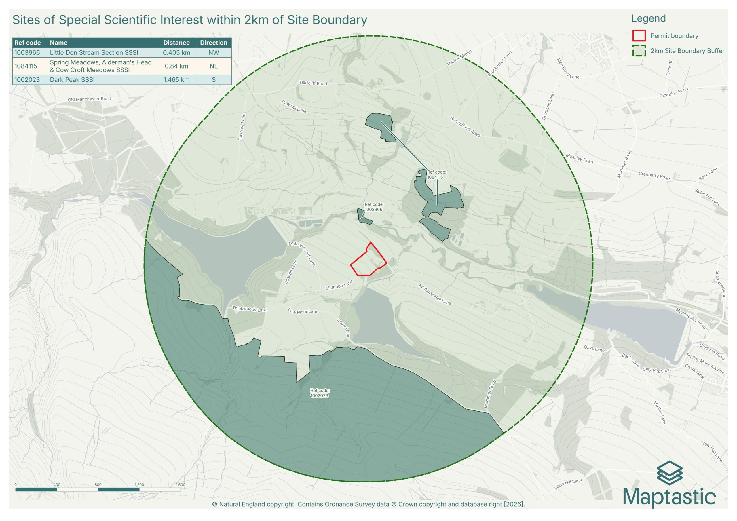
Figure 3 – Map output of results
What else can help you build GIS skills?
As with all skills, practise and being curious will take you far. Think about your skills development as an investment in your work and making those tiny improvements will pay off. Join online communities to ask questions and answer those posted that you can help with. There are a lot of open-source resources and people building useful tools out there.
Here are a few I’ve come across:
- Skipper-is (Github repositories)
David Caplin) has built tools for the environment and ecology sector with examples like the UKHab-QGIS style package – QGIS Style package for UKHAB/BNG surveying and mapping - Ordnance Survey (Github styles for their Open data)
If you’re using OS open data it’s worth checking out their styles that make the data look great with minimal effort!
- GCN-HSI — QGIS Plugin
A plugin built by Ciaran Egan that semi-automates the HIS calculations. - TomBio Tools – QGIS Plugin
QGIS plugin for biological recorders. Created with the FSC Tomorrow’s Biodiversity project – version 3 available in the Plugin manager and v4 available from here.
Note: I’ve not tested all of them in my work, please do your own due diligence.
About the author
Claire Birnie has spent a decade knee-deep in geospatial data for the environment, ecology and transport sectors — and she bloody loves a map too. At CIEEM’s 2026 Scottish Conference in Glasgow, she’ll be making the case for building your own GIS skills rather than handing them over, in her workshop: Introduction to QGIS Model Builder: Build a Workflow to Generate the Distance Between your Site & Statutory Sites.