
Book review – QGIS for Ecologists
 QGIS for Ecologists: An Introduction to Mapping for Ecological Surveys – by Stephanie Kim Miles
 QGIS for Ecologists: An Introduction to Mapping for Ecological Surveys – by Stephanie Kim Miles
The book is essentially a step-by-step guide on how to use QGIS for ecology and may also prove useful for conservation practitioners and scientists. It is divided into four parts: “Fundamentals”, “Workbook”, “Answers to questions”, and “Workflows”. The “Workbook” section is the main component with the most chapters and is essentially a how-to guide (with the “Workflows” section being more succinct and explicit). The book is intended for ecologists or anyone working in the conservation sphere with little or no prior experience in Geographic Information System (GIS), but who may need to produce maps for surveys or reports.
GIS is a system that integrates hardware and software for capturing, storing, analyzing, and managing spatial data or information—the latter being a digital representation of features on the Earth’s surface. To produce maps using GIS, one of several commercially available packages is needed. However, there are several free open-source software packages available, one of which is QGIS, the focus of this book.
Part 1 includes an introduction, information about the author, and answers the question: why QGIS?
Part 2 includes the most chapters (4–11) and is the primary focus of this review. The reader is first guided through downloading and installing QGIS on Windows PCs and Macs, and obtaining supplementary materials needed to follow the workbook (Chapter 4). Chapter 5 introduces the QGIS interface and data types needed to create a basic map. This is an important chapter, as the exercises provided will give the reader the necessary understanding and experience to use GIS and complete subsequent exercises. While this may seem obvious, there is sometimes a temptation to skip chapters and go straight to one of more immediate interest or need. The chapter includes useful definitions and exercises for exploring different data types, with questions designed to increase understanding of new concepts. The reader is also introduced to how these data are displayed in a GIS environment (using coordinate reference systems) and how data types with different coordinate reference systems can be transformed so that they can be displayed together. This chapter concludes with map-making basics, at the end of which a basic map is produced and exported.
Chapter 6 focuses on obtaining data from online sources, exploring and manipulating data needed for a site survey, and using these to produce maps for field use. Chapter 7 focuses on checking if there are any designated sites on or near a potential field survey site to determine site importance or the significance of any proposed work, again using data downloaded from online sources. Chapter 8 focuses on generating desk study maps—maps that include previous spatial information recorded or collected at the site. The example exercise uses records of beavers pulled from the National Biodiversity Network, where spatially referenced information on species occurrence is held and can be downloaded.
Chapter 9 is an important chapter, as it provides a practical example of how QGIS can be used with data the reader collects in the field. Specifically, it provides instructions on importing data collected using a Global Positioning System (GPS) into QGIS and displaying this information on a map. When I first used a GPS to collect coordinates in the field, I had to ask someone with GIS experience to import and display my data. It was not until I attended a week-long GIS course that I was able to do this and much more. At the time, I felt this was possibly my most important accomplishment when using GIS—I could record where I was in the field (my own data) and display this location on different maps. Here, the reader is provided with the steps to do this easily and independently.
Chapter 10 introduces georeferencing, a method by which any map, whether in digital or printed format (which can be scanned or digitized), can be brought into a GIS environment and assigned a coordinate system or a projection (a method for flattening the curved Earth onto a flat map) that matches that of the reader’s data. Chapter 11 provides instructions on producing a habitat survey map by using different data types introduced in Chapter 5. This is the second opportunity the reader has to create their own GIS data.
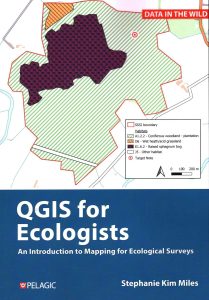
Overall, the book is a very useful how-to guide on using the free open-source software QGIS to produce maps for surveys and reports. The main body includes workbook-style instructions (appropriately entitled “Workbook”) that are very easy to follow and relevant to anyone seeking to produce maps or to become competent map makers. The chapters in this section carefully build on competencies and skills acquired after completing previous chapters and in the process introduce the reader to the rich GIS resources available for the UK. The same formula is kept throughout with questions included to increase understanding of new concepts. Although the title implies the target audience is ecologists, anyone working in species or habitat conservation will find it useful.