Eyes in the Night Sky: How Thermal Drones Took Off Around the UK
Written in anticipation of CIEEM’s 2026 Scotland Conference, Fieldwork Futures: Innovations in Ecological Practice, where Giles Coe of Co-ecology will be presenting.
The Start of Something New
Following their public launch at the 2024 Bat Technology Expo and a subsequent article in In Practice, thermal drones have seen rapid adoption during the 2025 and 2026 survey seasons. The pattern mirrors many technological innovations: initial uptake by sole traders and small consultancies, followed by medium-sized firms, particularly those already operating drone services. Larger multidisciplinary organisations are expected to follow as the benefits become increasingly established.
For Co-ecology, adoption was driven primarily by efficiency and practicality. Large, complex buildings often require significant numbers of surveyors equipped with Night Vision Aids (NVAs) to achieve adequate survey coverage. This can be costly, time-consuming, and logistically challenging. Thermal drones offered the potential for a single operator to achieve coverage equivalent to several surveyors while also observing areas of a structure that would otherwise be difficult or impossible to view from the ground.
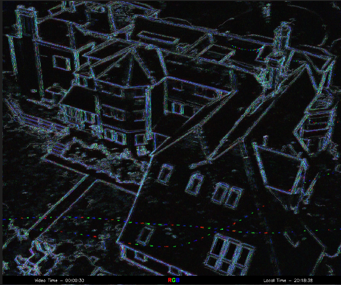
Early experience demonstrated that thermal drones, combined with automated video analysis, could identify multiple potential roost features that might otherwise be missed. Surveys that were previously difficult to undertake became both practical and repeatable, improving confidence in results while reducing resource demands.
At the same time, growing political and regulatory pressure to streamline ecological survey processes has increased demand for more efficient approaches. Debate surrounding the Planning and Infrastructure Bill, alongside public scrutiny of projects such as the HS2 bat tunnel, has encouraged the profession to seek methods that improve efficiency without compromising survey quality.
Why It Is Working
The thermal drones most commonly used for ecological surveys produce standard MP4 video files that display relative heat differences rather than detailed per-pixel temperature measurements. Compared with more advanced radiometric systems, this significantly reduces both hardware costs and data volumes while removing the need for specialist analysis software.
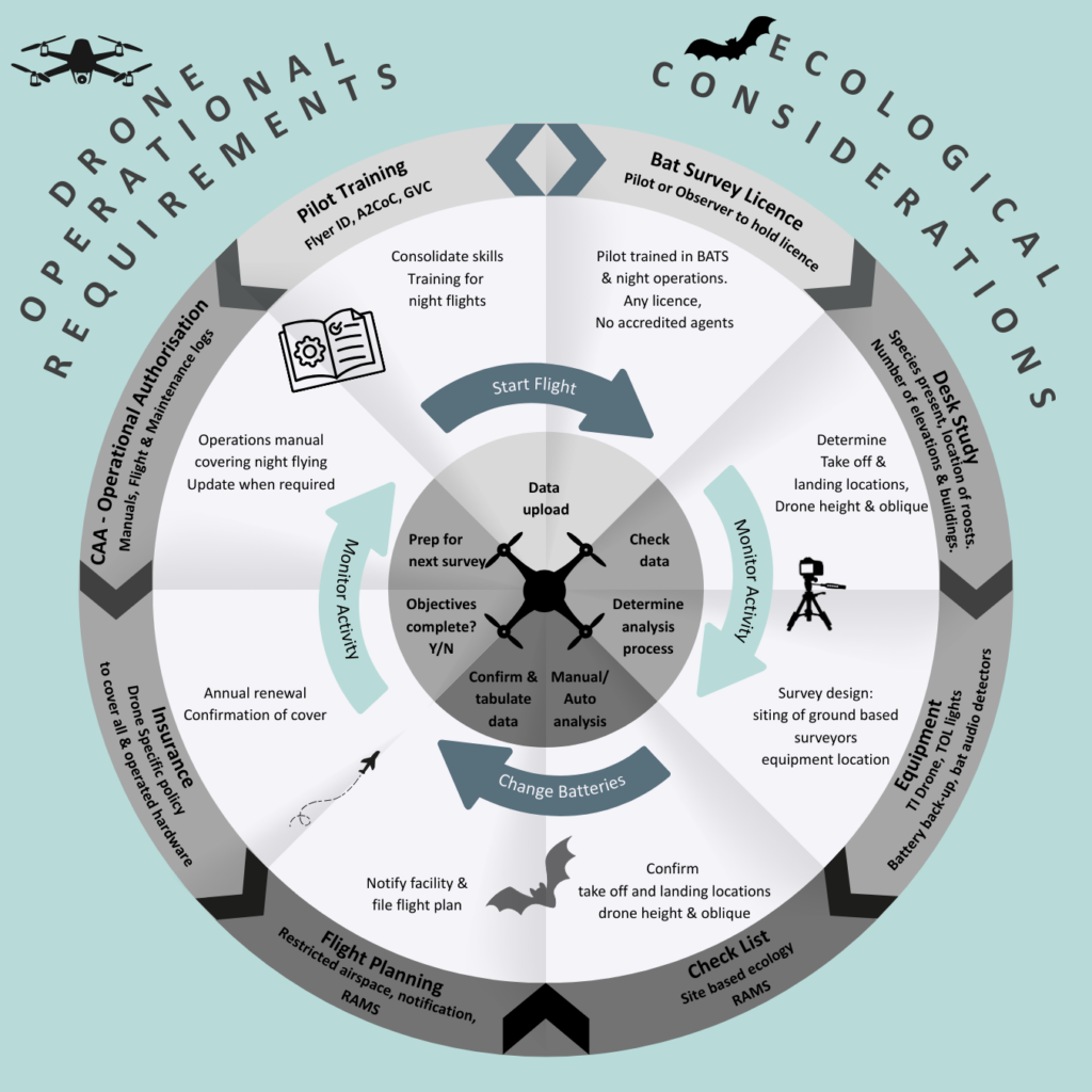
As a result, the technology has become much more accessible to smaller consultancies looking to expand beyond traditional ground-based methods. Although commercial drone operations require investment in training, compliance, and operational procedures, the regulatory requirements are generally manageable.
Organisations that choose not to develop drone expertise in-house can also access specialist providers. Alongside Co-ecology, companies such as WildTech Ecology and Thermal Vision Ecology established dedicated thermal drone services during 2026, creating an expanding marketplace for outsourced survey support.
Like any survey tool, thermal drones have limitations. Adverse weather, retained heat within building materials, vegetation cover, and complex building geometry can affect detection rates. Thermal imagery alone cannot reliably identify species and should be considered only one component of a wider survey design. Ecological expertise remains essential.
In practice, the greatest value of thermal drones is not replacing ecologists but helping them focus effort where it is most needed. By improving coverage and highlighting areas of interest, the technology can increase both efficiency and confidence in survey outcomes.
What Practitioners Are Saying
James Longley, WildTech Ecology:
Why I Moved to Drones
“One word: better data.”
I first saw the potential when Co-ecology demonstrated thermal drone technology in 2024. While ground-based thermal cameras are valuable tools, they are limited by relatively narrow fields of view. Drones provide a continuous, joined-up thermal image across a much wider area rather than relying on multiple separate viewpoints.
How I Am Using Them
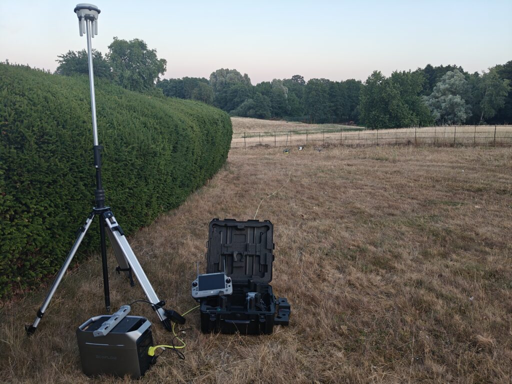
I currently use a DJI Matrice 4T for emergence surveys on both simple and complex structures, nesting bird inspections, mammal surveys, activity surveys, and orthomosaic mapping. Acoustic monitoring remains a crucial component, allowing thermal observations to be cross-referenced against recorded bat calls.
For analysis, I rely on WIS software, which transforms hours of raw video footage into data that can be searched, reviewed, and quantified efficiently.
Where It Is Heading
Although we now have an established methodology for bat surveys, there is still considerable scope for development. Practitioners can benefit from sharing information on camera settings, detection distances, and operational procedures. Future guidance may include multi-drone operations, tethered systems, and improved integration of acoustic datasets.
As adoption increases, clients and planning authorities will need confidence in what constitutes good practice, making standardisation increasingly important. Advances in artificial intelligence are likely to play a major role, with automated real-time detection becoming a realistic prospect. Meanwhile, drone technology will continue to improve through reduced size, lower costs, quieter operation, longer flight durations.
Ultimately, the drone is simply a tool. The real value lies in the improved understanding of bat behaviour and ecology that it enables.
oplus_2097152
Dr Liat Fernando, Thermal Vision Ecology:
Why We Added Drones to Our Services
At Thermal Vision Ecology, improving survey efficiency and accuracy has always been a priority. The adoption of thermal drones was therefore a natural progression.
Combining aerial thermal surveys with ground-based thermal cameras provides a more complete survey package for clients, delivering faster, safer, and more comprehensive assessments. Since launch, demand for these services has grown rapidly.
Our Approach
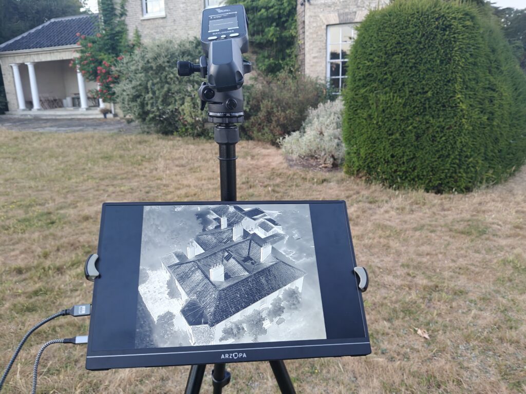
Rather than using drones in isolation, we integrate them within a broader survey methodology. DJI Matrice 4T and 4DT drones are used alongside TVE’s radiometric ground-based thermal cameras and strategically positioned acoustic detectors. This combined approach improves the likelihood of recording emergences from even the most challenging structures.
Future Direction
As thermal drone surveys become more widely adopted, consistent methodologies will be increasingly important. Detection performance can be influenced by drone settings, flight distance, and site geometry, all of which affect data quality and analysis outcomes.
It is encouraging that protocols being developed by Thermal Vision Ecology, Co-ecology, and WildTech Ecology show strong similarities, suggesting that industry consensus is beginning to emerge.
Looking ahead, the limitations of MP4-based systems are likely to drive further technological development. Radiometric drones capable of collecting more detailed thermal information are expected to improve detectability and analytical accuracy, particularly at greater distances.
Thermal drones represent another specialised tool available to ecologists, enhancing workflow, improving data capture, and increasing confidence in survey results. As the technology matures, its contribution to ecological practice is likely to continue growing.
About the Author
 This blog was written by Giles Coe MICEEM, Director at Co-ecology. Giles will be presenting on this topic at the upcoming 2026 Scotland Conference, Fieldwork Futures: Innovations in Ecological Practice.